Friday, April 10, 2015

Light Contrail Formation Expected Today for Central Wisconsin Flyway, Nesting Box Prep Ends Today

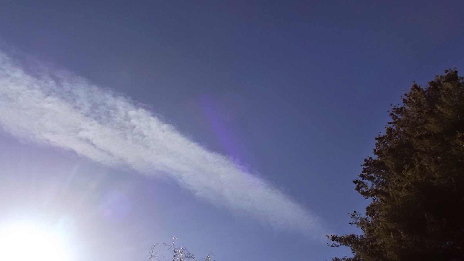
We are right on the cusp of some partial cloud clearing this afternoon with some breakup already apparent.  Patches of dry upper air also is swirling through the state. Conditions do not look good for aviaticus (aircraft) cloud formation today but Saturday we are expecting full blown spring to bully into the area.

Update: Clouds cover passed to mostly clear skies in the late afternoon.  Two aviaticus cloud segments could be seen in the far northwest and after an hour they had drifted overhead and appeared like natural cirrus. Not a whiff or a needle of contrail besides these formed all day.

Nature is poised and ready to explode.  Managed to clean out the bird nesting boxes yesterday and add inspection lids in preparation for nest monitoring.  It appears time is up for those activities as the ongoing jostling for territories by the early cold tolerant migrants is about to shift to breeding and nest building  . Ice went off the lakes this week.


A Tree Swallow Nest from  Last Year


Nest Boxes Made from and mounted on  Old Cedar Post.  This year I have installed inspection covers to monitor the clutches.


Wednesday, April 8, 2015

Adding Cloud Condensation Nuclei Analysis to my Future Aviaticus Cloud Forecasting...Someday???

Cloud Condensation Nuclei CCN

Professor Henrik Svensmark believes cosmic rays ionize the atmospheric gases and this forms an unknown percentage of the cloud condensation nuclei CCN that attract water vapor and form ice crystals and rain drops which form clouds. Simply, cosmic rays form some clouds. Under the right conditions can other unknown stimuli cause the formation of persistent and spreading aviaticus (Aviation) clouds?


In a slide show lecture he used this satellite image of exhaust clouds, not the common and familiar aircraft contrail images but this one is of ships off the coast of Europe.


Cloud Condensation Nuclei CCN Count Analysis

Presently CCN are captured by aircraft but of course the challenging move to satellite analysis is progressing.  Perhaps it it already being tested and used.  Right now companies such as Droplet Measurement Technologies DMT sell services and CCN gathering and analysis equipment to a variety of research laboratories but if and when CCN analysis by satellite is perfected, atmospheric, pollution and climate change researcher, weather modification applicators, aircraft manufactures will subscribe to satellite analysis services. 

A CCN Counter Sold by Droplet Measurement Technologies:


No aviaticus (aviation) cloud forecast for the next few days due to weather forecast of cloud cover. Next possible event should be Saturday 4/11/2015

http://theorioninitiative2.blogspot.com/2015/04/announcement-adding-cloud-condensation.html

Tuesday, April 7, 2015

Aircraft Clouds (cirrus aviaticus) Forecast for Central Wisconsin Flyway & German High Altitude Video

We have low cloud cover this morning in central Wisconsin along our flyway but indicators show that conditions do not appear favorable for visible aircraft trails (aviaticus clouds) in the upper atmosphere anyway.

Later this morning we should have partial clearing with possible aviaticus forming in the the thinner upper tailing clouds.  Also the local weather forecast calls for a chance of snow or rain.  So there may be some appearances of persistent aviaticus clouds preceding these denser clouds but overall we should not be seeing huge contrail events today.

In the video below from Germany, the guys used a GoPro and from an high altitude balloon filmed above the lower cloud deck. The film is for the most part sped up but once they get above the stratus formation they slow the speed down. Look carefully at 3:27 to 3:52 and it appears they captured a typical persistent cirrus aviaticus just to the left and below the sun!


Update: As clouds slightly broke in late AM, no trails could be seen during a period of busy travel. Progressively moderate breaking of cloud cover in mid-afternoon showed a thin cirrostratus had developed and one persistent and spreading aviaticus cloud. As lower clouds thinned, a long thin trails were blazed with durations of 2-3 minutes before dissipating. 

One interesting traffic anomaly. A line of west bound jets at 32,000-37,000 trailed by me and then tracked north a bit, then back south and back on their westerly track to Minneapolis as if avoiding something.  I couldn't see any weather on satellite that would explain why they were re-routed, just more cloudiness closing off the remaining blue. Turbulence? 

 From Flightradar24

http://theorioninitiative2.blogspot.com/2015/04/aircraft-clouds-cirrus-aviaticus.html

Sunday, April 5, 2015

Aerotrails: Why Some Contrails Last Longer than Others?

Anyone who studies and writes about aircraft clouds realizes there is a need for a new vocabulary for contrail studies and descriptions.  Roland Nunez from Embry-Riddle Aeronautical University in an interesting paper that was published in 2014, writes about this.  He also used the term 'areotrails', a contraction of aerosol trails, basically the unseen soot pollutants in aircraft exhaust. These invisible trails may explain why some persistent trail clouds are larger, spread wider or last longer than other persistent aviaticus trails. All jets leave aerotrails and there were over 37,000,000 flights scheduled last year, 37 million invisible areotrails! This does not include private, scientific and military flights.

When aviaticus (aircraft) clouds are formed, are the nuclei of which the water vapor attach to and form ice crystals natural atmospheric nuclei such as volcanic particles?  Or are they from the soot particles?  A combination of both?  I would guess the combination of both. In a cold high humidity area of the upper atmosphere that is also saturated with natural nuclei, wouldn't the extra nuclei introduced from the jet exhaust cause the formation of more ice crystals and thus a more robust cloud?  Then as the trail clouds drift and mix into even higher humidity and colder areas or areas with higher natural nuclei, couldn't the clouds continue to expand?  Is it possible some of the cirrus clouds we see and assume are natural, are formed when invisible aerotrails drift into and mix with atmosphere that is more conducive for cirrus formation but lacking natural nuclei?  Could the mix of natural and aircraft exhaust nuclei explain the milky clouds (cirrostratus aviaticus) during heavy contrail events?

No contrail forecast for central Wisconsin today.  Even though it did not look like the conditions were right for aviaticus formations, the weather forecast was for cloud cover anyway. We did start out with a nice AM 'blue out', with not one whiff or needle of trail.  But just before the cloud front moved in a few segments of persistent aviaticus trails were seen.

http://theorioninitiative2.blogspot.com/2015/04/aerotrails-clue-to-why-some-contrails.html

Saturday, April 4, 2015

Contrail Forecast: Blue 'n Dry at the Surface and Upper Atmosphere for Central Wisconsin Today

No Short or Persistent Aviaticus Trails for today.  A great day for outdoor photography if you want to avoid man-made clouds in the background.

Update 4/5/2015:  No short whiffs or persistent clouds (cirrus aviaticus) formed yesterday, no milky sheets (cirrostratus aviaticus) or remnant segments (cirrus aviaticus) drifted into the area. 

Thursday, April 2, 2015

Today's Aviaticus (Aircraft Clouds) Forecast For our Central Wisconsin Flyway


Gray matter, talking clouds here,  not to be confused with the theoretical and ever elusive 'Dark Matter'  of the universe, will be moving out of Central Wisconsin starting in early afternoon.  We should have some thinning residual clouds coat tailing those exiting thick gray clouds  and that may be the best time for contrail formations and viewing.  Later we have a section of low vapor air crossing our area and another possible total blue out where not even whiffs and needles of trails will be visible.  Cirrostratus aviaticus clouds (milky thin cirrus layers) are not likely.  


We will have good east to west high altitude air traffic at that time during the afternoon so it will be interesting to watch the trail development or lack of development during the transitions.

End of Day Update: 

About noon the the gray clouds shifted out of the area and were tailed by high thin, but not transparent clouds that revealed the remnant of jets from the east west corridor as forecasted. The sun dog indicates the ice crystals and a fine medium for aviaticus formation:


Further west and approaching was the clear less humid atmosphere.  Here the first break in this long cloud event a west bound aircraft laying a visible trail. This cirrus aviaticus dissolves as it passes through the blue zone, then appears again as it crosses over a thicker remnant of the cloud front:


The rest of the day was a tangled mix of areas of cirrus and clear sky allowing the formation short trails and a few persistent trail. Here a segments drifts by. No cirrostratus aviaticus formed all afternoon:


http://theorioninitiative2.blogspot.com/2015/04/todays-aviaticus-aircraft-clouds.html

Wednesday, April 1, 2015

Aviaticus Pencils in the Sky Grow to Cane Poles

This morning in the west to east fly lane short aviaticus trails were being painted in the partly clouding skies. As more clouds moved in the contrails grew from pencil size (if you were to hold a pencil over your head) to half the viewing hemisphere. All dissipating quickly and then overcast ruled and goodbye sunshine with the increasing cloud cover that moved in.  Two short persistent segments could be seen in the south prior to cloud cover.  Perhaps some broken clearing this afternoon and upper atmosphere weather may bring about another viewing event before sunset.

UPDATE:  The cloud cover passed in early afternoon and the traffic began stroking out the elongated trails.  But mid after noon with heavy traffic along the east west flyway the cirrus aviaticus became quite numerous.  As they began to slowly spread, cirrostratus aviaticus formed within the natural and very thin cirrostratus.  Nice show.

This Canadair CRJ left a persistent aviaticus that was still in view and fairly tight even after I confirmed the landing in Minneapolis. Map from Flightradar24


An east bound Boeing at 34000 and a west bound Canadair CRJ-200 at 31000 appeared to be heading for a collision on the iPad, still impressive in the photo:


http://theorioninitiative2.blogspot.com/2015/04/aviaticus-pencils-in-sky-grow-to-cane.html