Showing posts with label cirrus aviaticus. Show all posts

Tuesday, November 10, 2015

Quick Built 20 year Layered Garden

Just finished a small layered garden.  Originally I planned it to be 200 SQFT but scaled it down to 180 once I plotted out the pegs.  In this one I used 100% of materials I had on hand, most used/recycled so there was zero additional cost except for labor. I rushed to build it as the fall material availability is starting to decline as most of the leaves have fallen and gardens cleaned up.  We still the archaic term for these organic materials as 'waste', I see it as a secondary harvest, leaves, lawn clippings, shrub and tree trimmings, annual flowers.

In this one we will use secondary food products:  peelings, plant leftovers, egg shells, coffee grounds, rinds. At a pound a day times 365 days, the nitrogen factor should be solved even if most of the material, dead leaves are carbon.   Cut and drive in 4'- 2"x4" stakes leaving 2' above grade:


Wife says OK but make it pretty.
  
Added 2' high wire fencing and at the base of the perimeter, 6" planks of old fence planks to I can keep the perimeter trimmed


Inspired by Hugelkultur, the first layer was thicker wood branches, directly on the soil


Next began layering with other second harvest material: leaves, trimming, discarded plant material from the neighborhood. 

Final step is to fill it up with second harvest material this week and let it cook down over the winter until spring planting if enough of the organics have broke down by then.


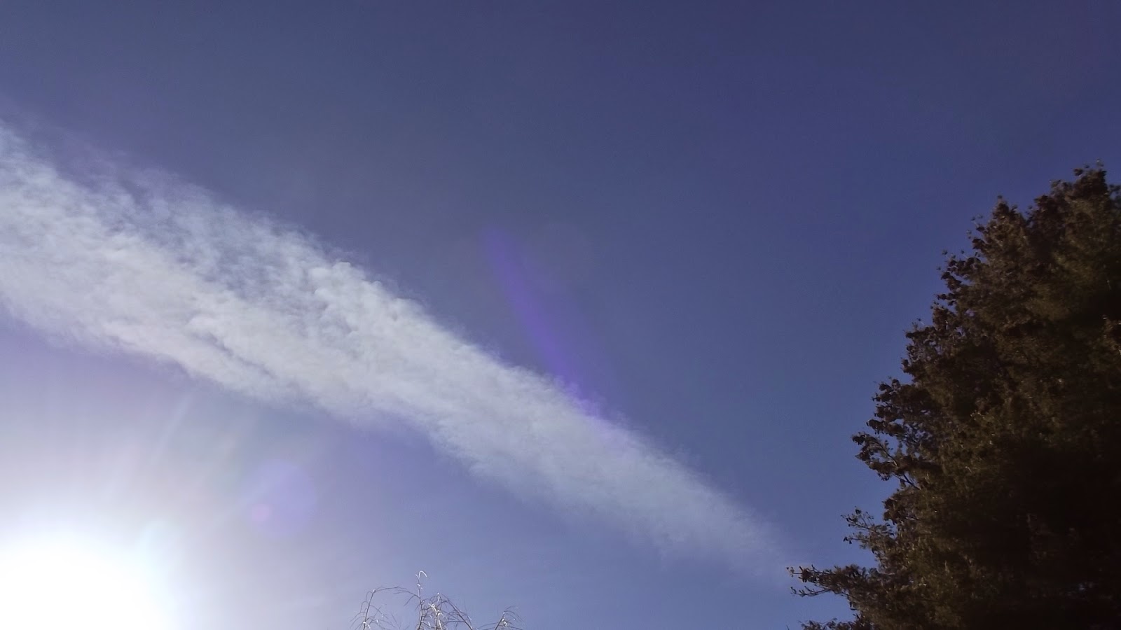
Aviaticus Clouds are forming in the encroaching boundary sheet, rain on the way so the moisture will accelerated the decomposition.
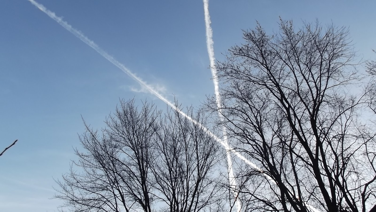
I expect the structure to last at least 20 years and if ever abandoned the soil will be left improved.

We daily had added lots of organic material, potato peelings, egg shells, coffee grounds.... After cooking down a couple months I added another layer before the snow:

First a load of cardboard from a local company, the cardboard may suppress unwanted plant growth:


Then I intercepted another load of wet leaves from the neighborhood that was destined for the landfill:

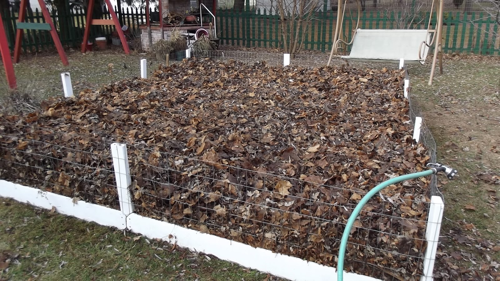

The rest of the winter we will continue to top this off with organic materials.

Tuesday, April 28, 2015

Forecasting A Day Long Aviaticus Cloud Event over the Central Wisconsin Flyway

4/28/2015 0700 CT: It appears by the indicators we should have good aviaticus cloud production by this afternoon. An air mass is moving in from the west-northwest and it appears a distinct boundary line (sheet) will precede this.

Update:  The indicators were correct.  NASA's Rapid Update Cycle  map based on the old Appleman Chart however did not show the likelihood of contrail formations.  I can say this is evidence that human analysis will be necessary for forecasting aviaticus events as the RUC model does not take into consideration present/past meteorological and flight tracking patterns.


The Boundary Sheet precedes this cloud mass, the 'dash' within the circle is our flight corridor, infrared map site:


Moisture Map at 7:15AM shows a trace of the Boundary Sheet pushing out the dry air (dark band). At 7:30AM when the first west bound aircraft passed over the green dash, they left segmented persistent aviaticus clouds (water vapor site):


First trails from west-bounds at 7:30AM (Looking East):


Here is the RUC map at that time indicating no upper air conditions for contrail formations in our flyway (White Dash):


In early afternoon RUC indicated favorable conditions: 


At that time both infrared and moisture maps indicated the boundary sheet was right over the flyway as indicated in these screen shots: Maps from NOAA Site


At that time I needed to drive north of our Flyway 7 miles and this is what the cloud cover looked like at the time the above maps were displayed:

Looking North away from the Flyway, note generally natural cirrus:


Looking south into the Flyway with both natural and aviaticus clouds:


As of 5:00PM CT persistent spreading aviaticus clouds are still being formed. Here is a remnant segment from a nice spreading trail:


Typically these trails from the northwest transports are Asian flights to Chicago.  Using the flightradar24 playback, my best guess from when the trail was laid and figuring drift of the formation, this was the aircraft that laid the above aviaticus trail:


At 6:00PM CT a parade of aircraft in quick succession passed through the Flyway leaving some nice trails within the thin aviaticus cirrostratus cloud layer that had developed or had mixed with the natural clouds:


During the night the cloud mass(es) passed through being coat-tailed by mid-altitude clouds and not even a whiff or pencil of short term aviaticus. 

http://theorioninitiative2.blogspot.com/2015/04/forecasting-day-long-aviaticus-cloud.html

Thursday, April 23, 2015

All Clear on the Central Flyway Today, here is why not a single contrail is to be seen:

Fabulous cool clear blue day with dry upper air and not a spit of an aviaticus trail or hint of a drifting cirrus to be seen.  Where are the aircraft? They can be heard flying over but only with a sharp eye or binoculars can they be spotted today.  They are all laying out sub-visual aerotrails of water vapor, cloud condensing nuclei such as soot.  The cloud mass exited over night and during that time the boundary line passed over the Central Wisconsin Flyway, even if conditions were right for contrail formation not that many flights were scheduled then.

Here are some photos that demonstrate why the aviaticus clouds (contrails) are not forming today:

A wide swath of dry air is covering most of the state of Wisconsin so exhaust vapor is not condensing on the cloud condensing nuclei spewed by the aircraft. Maps of Water Vapor &  Infrared from NOAA Site.


Below is a map of cloud cover with a line drawn to show the approximate corridor of jet traffic


We have a forecast for light rain Friday night 4.24.2015 so the best chance of an aviaticus event would be Friday when a moister boundary line passes through the Flyway from the Northwest prior to overcast.

Update:  Only light non-persistent aviaticus continued through Friday until the overcast covered the view. But as the overcast broke a bit Saturday morning remnants of persistent trails could be seen but no new trails could be seen in the broken cloud cover the rest of the day. 4.25.2015


4/26/2015  0600 CT:  This morning a huge mass of clear day air swung in from the north but it appears a blurred boundary line is following with a bit more moisture so by the time air traffic begins in another hour the transports should sport only short whiffs, if any at all.  The rapid update cycle map does show possible contrail forming conditions in the eastern segment of this flyway but I won't know until the Sunday morning traffic begins if those conditions remain or pushed south and aviaticus actually form.

Note small blue circle within the large white circle near Green Bay on the east side of our east/west Flyway on the Rapid Update Cycle Map:


4/27/2015 1800 CT: The same weather pattern continues. Short to no contrails, none persistent from morning until noon.  Interesting water vapor pattern.  Again the dry area dominated the flyway as moister air pushed in from the east and surface winds were from the north, the dry air (browns and blacks) became faintly stratified with bands of moister air (white) as seen on this map (water vapor site)


At this time loose bands of natural cirrus clouds were moving through.  By noon a few segments of persistent aviaticus clouds could be seen as aircraft would traverse these areas.  By later afternoon the stratification was gone. Then that air mass had pushed over the flyway as seen in the map with more moister air (white area) replacing it. Infrared Map Site


Some trails became longer but none would persist and a few depending on altitude left short segments as they passed through the cooler moister air:


This photo is looking east from the east/west Flyway. Note a persistent segment of aviaticus clouds.  The natural cirrus may be at or near the same altitude as the aviaticus segment.  These cirrus clouds did not show up on the infrared map but I'm associating these natural and aviaticus cirrus with the bands or lighter areas of moister air.


4/28/2015 0700 CT: It appears by the indicators we should have good aviaticus cloud production by this afternoon. An air mass is moving in from the west-northwest and it appears a distinct boundary line (sheet) will precede this.

http://theorioninitiative2.blogspot.com/2015/04/all-clear-on-central-flyway-today-here.html

Saturday, April 18, 2015

Short Aviaticus Event This Morning Along the Central Wisconsin Flyway


A wide band of high clouds on the edge of a boundary sheet has moved through the center of Wisconsin this morning, preceding  heavier clouds from the southwest, a pattern repeated in the last 5-6 days.  The difference this time is that rain is predicted so as this first wave of pre-precipitation  mass moves in, what  aviaticus pattern will follow?  It is mid-morning so air traffic has slowed and so I'm not sure if it is a hiatus in the traffic or if a band of dryer/warmer air is passing over but the water vapor map indicates it is band of dry air.  However cirrus are still moving in from the Southwest but I can not tell if they are natural or aviaticus.  

My prediction is that the persistent trails will cease during this present period of dryer upper air and just before the thicker clouds move in,  they will again form.  Any sky watcher north in northern Wisconsin would be thinking that same thing as our aviaticus clouds drift north.  Here are directional shots of the event.

Early this morning, looking east where the aircraft originate:


Two views looking south into the flyway (note white Horizon):


Looking North out of the Flyway to where the Aviaticus are drifting (note clear horizon):


http://theorioninitiative2.blogspot.com/2015/04/massive-day-long-contrail-event-of.html

Wednesday, April 15, 2015

It is Time for Professional Meteorologists to Step Up & Begin Forecasting the Big White Elephant in the Sky

Over the last last 4 months I have attempted to forecast contrail events for Central Wisconsin. Untrained in meteorology and particularly in upper atmospheric science, I have had to rely on ground based observations of weather and air traffic patterns and national weather maps and local weather forecasts.  Here are a few things I have learned or observed:


  1. All combustion aircraft leave a persistent trail, invisible from the ground, called an aerosol trail, aerotrail for short.
  2. The aerotrails are composed of cloud condensation nuclei. (CCN) These are basically small particles of soot that may form into water droplets or ice crystals depending on the temperature of the air.
  3. All combustion aircraft add water vapor to the atmosphere.
  4. The lengthening or shortening of contrails (cirrus aviaticus) indicates areas of temperature or moisture changes in the upper atmosphere or both.
  5. When contrails of short duration begin to lengthen, going to needle size, to pencil, to fishing pole, expect persistent contrails to begin forming. 
  6. As drier or warmer upper air masses move into flyway areas expect to see the contrails become shorter in length and duration or not appear altogether.
  7. When natural cirrus clouds move through a flyway, contrails will more likely be visible.
  8. Multiple persistent trails may spread to form milky sheet clouds. I call these clouds cirrostratus aviaticus.
  9. Persistent contrails most likely form on either side of moisture boundary lines, sometimes called dry lines. These boundary lines can be wide and I call them boundary sheets.
  10. As the boundary sheets drift within the flyway additional aircraft pass though them laying more invisible aerotrails and moisture making the cirrostratus aviaticus denser in appearance.
  11. If the drift is in the direction of the predominant flyway traffic the ice crystal saturation can lead to the viewing of or at least enhance sun dog halos.
  12. If  the persistent cirrus aviaticus (contrails) or cirrostratus aviaticus (milky sheets) drift outside the flyway, they tend to thin or dissipate.  With the lack of traffic no more man-made nuclei is added.
  13. So far, from identifying the aircraft using flight tracking software,  I have not been able to identity any deliberate laying of chemtrails (chemical trails)
  14. All the phenomenon I have observed so far has been from regular commercial airline traffic flying between 30,000-40,000'.
Today we have heavy persistent cirrus aviaticus clouds forming and morphing into cirrostratus aviaticus within the Central Wisconsin Flyway.

http://theorioninitiative2.blogspot.com/2015/04/it-is-time-for-professional.html

Tuesday, April 14, 2015

Contrail (Aviaticus Clouds) Forecast for Central Wisconsin: Great Day for Photography if You Want to Avoid Man-made Clouds

A wide swath of dry upper air slightly streak with areas of moisture but without any distinct boundary lines will be over the Wisconsin Flyway today.  We should have some hit and miss aviaticus trails tomorrow and Thursday as conditions become a bit more mixed and complex. I'll try to post an update if boundary sheets with moist air become evident.

Update: Wrong! Before noon the dry upper air pushed north and cirrus and sections of cirrostratus moved in from the a southwest front.  Only short trails were seen earlier but as the dry air was replaced small segments of persistent aviaticus clouds (contrails) were scattered about though for the most part trails remained short with quick dissipation. This continued to increase into the afternoon dividing the state into two hemispheres, the dividing line going right over my location. So looking north I would see clear skies, south thicken cirrus of both natural and aviaticus. 

A Boundary line is shown below but again the boundary sheet of moister air reaches further north of the line as this mass inches north so contrails (aviaticus clouds) and longer non-persistent trails formed.  Oddly, the meteorologist were all correct, we had sun all day as the clouds were too thin to block it. How much of the cloudiness was cirrostratus aviaticus is the question.  Natural cirrus were present in the early morning but the continual additions of nuclei to the moving boundary sheets may be the greatest factor. This is why meteorologist need to make contrail forecasts.  Sunny skies do not mean clear blue skies especially along the flight corridors.                                  

                                               Infrared Map: From NOAA Site


Moisture Map, Darker Area indicates Drier Air: From NOAA Site


From the Boundary Line Looking South into the Flyway


http://theorioninitiative2.blogspot.com/2015/04/contrail-aviaticus-clouds-forecast-for.html

Saturday, April 11, 2015

Contrail Forecast for Central Wisconsin & Spotting Near Invisible High Altitude Aircraft

4/11/2015 7AM As a line and formation of commercial jets cross Lake Michigan tracking toward our general flyway in Central Wisconsin, I rush through my basic procedure of analysis to formulate today's aviaticus cloud forecast before these craft come into view.  If any contrails are viewable today, they only should be of short length and duration but overall we should see no aviaticus clouds this morning or this afternoon.


Update: 7:00-7:30AM All traffic along the west-East flyway displayed  short duration needle -like aviaticus clouds. All traffic was between 35-36000' with the exception of one flight at 26000 and climbing that displayed no trail.

                                                   How to Spot Aircraft that are not Sporting Contrails

First learn the flight patterns in your area.  To do this I ended up using Flightradar24 site.  This was recommended by Mick West and others from Metabunk.  I use it on laptop, desktop and iPad. 
With normal vision it is quite easy to spot aircraft above 30000' if they are trailing even a short whiff of white.  But at times aircraft will streak out a trail between 35-36000' and none at 34,000'. Or even depending on location some aircraft within the same elevation range will trail but others will not.

Years ago I learned some methods of improving vision as I used to wear glasses and wanted to explore the possibility of improving my vision after my optometrist emphatically told me 'there is nothing you can do.' (Other than wear glasses!) He was wrong.  One exercise I began was viewing 3 dimensional sterograms.  Most people are familiar with these. You lazily stare at a picture and suddenly objects appear in 3D that were not visible in the 2D format.

When we scan a completely blue sky we are only focusing right in front  of our face and not 7 miles away.  Changing focus to that range is difficult because there is no reference point so we do not perceive we are just scanning an area in front of our noses.  Hold up one finger at arms length in front of your face and focus on it and you see a single finger, now with the finger still in view look beyond it to the open sky, you will see two fingers though you are not focusing on them, you are looking beyond them, your individual eyes have actually separated (diverged)and you are focusing out and have a better change of spotting a trailess aircraft.


Binoculars work as well of course but you'll want to pre-focus on a distant object otherwise you may doing an out of focus scan just as with the naked eye.  This morning the moon was visible so I used that to set my focus.  Sill you should know the approximate location of aircraft and this is where I use the flight tracker. With an inexpensive app, high altitude aircraft can be approximately located by scanning the sky with the iPad camera.  I prefer the iPad because of the large screen.  Most aircraft are actually ahead of where they are plotted on the iPad screen simply because of information transmission delays.  So if you spot an aircraft on a flight tracker screen that is 20 miles away, start scanning the sky at it may already be passing by or down range.  I love practicing without binoculars when there is time.  Great exercise for the eyes.

The first arrival this morning while I was using the focus method, easy to spot though as it was trailing an aviaticus whiff:


http://theorioninitiative2.blogspot.com/2015/04/contrail-forecast-for-central-wisconsin.html

Friday, April 10, 2015

Light Contrail Formation Expected Today for Central Wisconsin Flyway, Nesting Box Prep Ends Today

We are right on the cusp of some partial cloud clearing this afternoon with some breakup already apparent.  Patches of dry upper air also is swirling through the state. Conditions do not look good for aviaticus (aircraft) cloud formation today but Saturday we are expecting full blown spring to bully into the area.

Update: Clouds cover passed to mostly clear skies in the late afternoon.  Two aviaticus cloud segments could be seen in the far northwest and after an hour they had drifted overhead and appeared like natural cirrus. Not a whiff or a needle of contrail besides these formed all day.

Nature is poised and ready to explode.  Managed to clean out the bird nesting boxes yesterday and add inspection lids in preparation for nest monitoring.  It appears time is up for those activities as the ongoing jostling for territories by the early cold tolerant migrants is about to shift to breeding and nest building  . Ice went off the lakes this week.


A Tree Swallow Nest from  Last Year


Nest Boxes Made from and mounted on  Old Cedar Post.  This year I have installed inspection covers to monitor the clutches.


Sunday, April 5, 2015

Aerotrails: Why Some Contrails Last Longer than Others?

Anyone who studies and writes about aircraft clouds realizes there is a need for a new vocabulary for contrail studies and descriptions.  Roland Nunez from Embry-Riddle Aeronautical University in an interesting paper that was published in 2014, writes about this.  He also used the term 'areotrails', a contraction of aerosol trails, basically the unseen soot pollutants in aircraft exhaust. These invisible trails may explain why some persistent trail clouds are larger, spread wider or last longer than other persistent aviaticus trails. All jets leave aerotrails and there were over 37,000,000 flights scheduled last year, 37 million invisible areotrails! This does not include private, scientific and military flights.

When aviaticus (aircraft) clouds are formed, are the nuclei of which the water vapor attach to and form ice crystals natural atmospheric nuclei such as volcanic particles?  Or are they from the soot particles?  A combination of both?  I would guess the combination of both. In a cold high humidity area of the upper atmosphere that is also saturated with natural nuclei, wouldn't the extra nuclei introduced from the jet exhaust cause the formation of more ice crystals and thus a more robust cloud?  Then as the trail clouds drift and mix into even higher humidity and colder areas or areas with higher natural nuclei, couldn't the clouds continue to expand?  Is it possible some of the cirrus clouds we see and assume are natural, are formed when invisible aerotrails drift into and mix with atmosphere that is more conducive for cirrus formation but lacking natural nuclei?  Could the mix of natural and aircraft exhaust nuclei explain the milky clouds (cirrostratus aviaticus) during heavy contrail events?

No contrail forecast for central Wisconsin today.  Even though it did not look like the conditions were right for aviaticus formations, the weather forecast was for cloud cover anyway. We did start out with a nice AM 'blue out', with not one whiff or needle of trail.  But just before the cloud front moved in a few segments of persistent aviaticus trails were seen.

http://theorioninitiative2.blogspot.com/2015/04/aerotrails-clue-to-why-some-contrails.html

Saturday, April 4, 2015

Contrail Forecast: Blue 'n Dry at the Surface and Upper Atmosphere for Central Wisconsin Today

No Short or Persistent Aviaticus Trails for today.  A great day for outdoor photography if you want to avoid man-made clouds in the background.

Update 4/5/2015:  No short whiffs or persistent clouds (cirrus aviaticus) formed yesterday, no milky sheets (cirrostratus aviaticus) or remnant segments (cirrus aviaticus) drifted into the area. 

Thursday, April 2, 2015

Today's Aviaticus (Aircraft Clouds) Forecast For our Central Wisconsin Flyway


Gray matter, talking clouds here,  not to be confused with the theoretical and ever elusive 'Dark Matter'  of the universe, will be moving out of Central Wisconsin starting in early afternoon.  We should have some thinning residual clouds coat tailing those exiting thick gray clouds  and that may be the best time for contrail formations and viewing.  Later we have a section of low vapor air crossing our area and another possible total blue out where not even whiffs and needles of trails will be visible.  Cirrostratus aviaticus clouds (milky thin cirrus layers) are not likely.  


We will have good east to west high altitude air traffic at that time during the afternoon so it will be interesting to watch the trail development or lack of development during the transitions.

End of Day Update: 

About noon the the gray clouds shifted out of the area and were tailed by high thin, but not transparent clouds that revealed the remnant of jets from the east west corridor as forecasted. The sun dog indicates the ice crystals and a fine medium for aviaticus formation:


Further west and approaching was the clear less humid atmosphere.  Here the first break in this long cloud event a west bound aircraft laying a visible trail. This cirrus aviaticus dissolves as it passes through the blue zone, then appears again as it crosses over a thicker remnant of the cloud front:


The rest of the day was a tangled mix of areas of cirrus and clear sky allowing the formation short trails and a few persistent trail. Here a segments drifts by. No cirrostratus aviaticus formed all afternoon:


http://theorioninitiative2.blogspot.com/2015/04/todays-aviaticus-aircraft-clouds.html

Wednesday, April 1, 2015

Aviaticus Pencils in the Sky Grow to Cane Poles

This morning in the west to east fly lane short aviaticus trails were being painted in the partly clouding skies. As more clouds moved in the contrails grew from pencil size (if you were to hold a pencil over your head) to half the viewing hemisphere. All dissipating quickly and then overcast ruled and goodbye sunshine with the increasing cloud cover that moved in.  Two short persistent segments could be seen in the south prior to cloud cover.  Perhaps some broken clearing this afternoon and upper atmosphere weather may bring about another viewing event before sunset.

UPDATE:  The cloud cover passed in early afternoon and the traffic began stroking out the elongated trails.  But mid after noon with heavy traffic along the east west flyway the cirrus aviaticus became quite numerous.  As they began to slowly spread, cirrostratus aviaticus formed within the natural and very thin cirrostratus.  Nice show.

This Canadair CRJ left a persistent aviaticus that was still in view and fairly tight even after I confirmed the landing in Minneapolis. Map from Flightradar24


An east bound Boeing at 34000 and a west bound Canadair CRJ-200 at 31000 appeared to be heading for a collision on the iPad, still impressive in the photo:


http://theorioninitiative2.blogspot.com/2015/04/aviaticus-pencils-in-sky-grow-to-cane.html